National Parks of Alberta and British Columbia, Canada
|
|
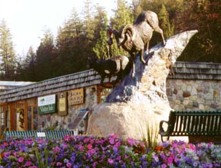
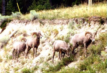
| The Kootenay NP visitor center is in town of Radium Hot Springs. The park starts at the eastern edge of the town. | This area of BC has a lot of Big Horn Sheep. This group of four males were beside the highway just south of Radium Hot Springs. |
We only found two items of interest in Kootenay National Park. One was a fire that was started by lightning, and the other was Marble Canyon. Many trees scattered through Kootenay are dead due to an insect problem. We were told that a controlled burn was planned for the park, and the lightning simply gave an early start to the planned fire. Smoke from the fire at times made very poor visibility along the Kootenay Parkway through the park. At night, the fire was actually quiet beautiful.
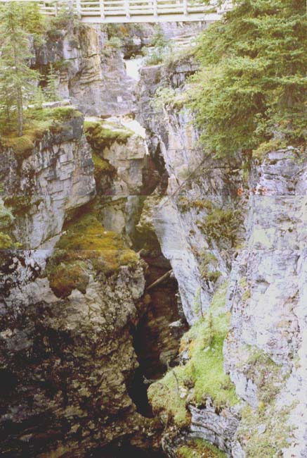 |
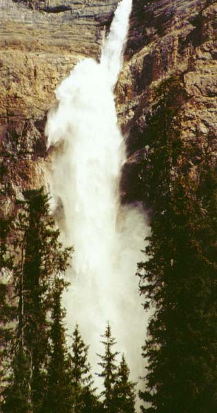
Marble Canyon is unlike most other canyons in that it originated as a crack in a layer of rock that was pushed up and folded by some ancient geologic event. Tokumm Creek, fed by a melting glacier, runs through this crack, enlarging the canyon to make the canyon deeper and wider at the bottom. Since the water did not erode the rock at the top, the sides of the canyon are much closer at the top than down deep. This composite photo shows the water entering the canyon as a waterfall just below the bridge at the top. The sides of the canyon are too close and too crooked to see more than just the top of the falls from here. The water is visible underneath the bridge from where these photos were shot. While the falls are supposed to be only a 15 minute walk from the parking area, I was on the trail for almost two hours. Going is all uphill and stairs, and there is lots of beauty to admire and photos to shoot. These photos were all shot near sundown. |
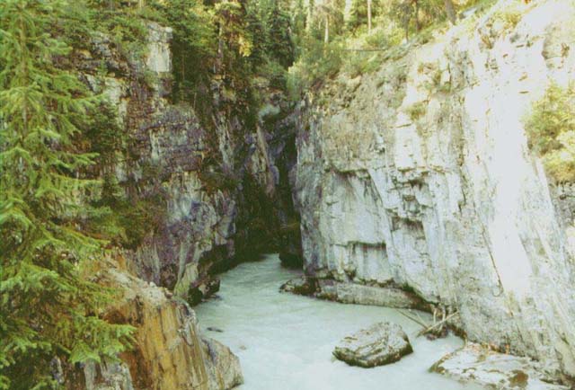 |
| Tokumm Creek emerges at the lower end of the canyon and joins the Vermilion River at the parking area. Being glacier fed, Tokumm Creek is milky colored with ground rock. |
There are beautiful lakes, beautiful waterfalls, and beautiful mountains in Yoho National Park.
 |
| Emerald Lake is one of the most popular since it has a restaurant and other facilities. Tour busses bring lots of visitors, and several park trails start here. It is a beautiful lake surrounded by beautiful mountains. |
 |
Takakkaw Falls Takakkaw means "magnificent" in the Cree language. Takakkaw Falls is truly magnificent. It is one of the highest falls in Canada, and is the most beautiful high falls that I have seen. You can drive to a large parking lot near the falls, and you can easily walk right up to the base of the falls. I understand there is a trail to the top of the falls, but that did not interest me. Even with this close access, there are many places to view and photograph the falls without people in the way. The water drops from a notch and falls as a stream for about 20 % of its height. It then hits a ledge and bounces into an ever-changing horsetail falls as it continues down the mountainside. The closer you get to the base, the more magnificent it looks, but expect to get wet when you get close. Takakkaw Falls is glacier fed, and 14 August 2001 was a very hot day, giving a very ample water supply to the falls. Yoho Glacier, visible from the Takakkaw Falls area, creates the Yoho River that passes near the base of the falls. A footbridge over the river provides access to the falls. |
We did not visit Banff National other than driving through part of it. We did visit the town of Banff, and as in 1997 when we first visited, the great number of people crowded into the small town prevented our exploring and enjoying the otherwise beautiful town. We ate at a unique establishment, Btfsplk’s Diner. Joe Btfsplk is the Lil’ Abner character with the dark cloud over his head.
We also found that Lake
Louise was even more crowded than Banff. From Lake Louise we
drove north to Jasper, in Jasper National Park, with a stop at the icefields and a walk on
Athabasca
Glacier. Athabasca Glacier appears to be little changed from 1997.
| The Columbia Icefield, is visible from the Icefield Parkway through Jasper National Park. The Athabasca Glacier flows toward the highway from the icefield. | 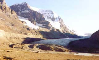 |
| A parking area and trail, upper right, leads to the glacier. Several years ago, the glacier covered the present parking area. | 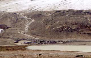 |
| People walk out on the glacier, but there are warning signs to not do so. Crevices form in the ice and people fall in them and die. The brown color to the glacier, right, is from dirt tracked onto the ice. The man in the foreground is on the rock and dirt dam deposited as the glacier front edge melts. A sign indicated that one man died in a crevice just 10 feet from the edge where the dark area is. | 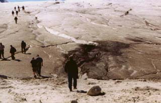 |
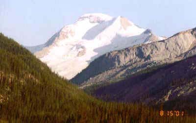
| For beautiful mountain scenery Jasper NP is about as good
as can be found. This was one mountain seen from the highway.
The town of Jasper is also very pleasant. Jasper was not crowded at all, even though the rodeo was to start the evening after we were there. |
 |
| In 1997, the town of Jasper in Jasper NP had elk scattered all through town. This year no elk were seen in town. Large bull elk were common along the highway north of the town in 1997, but not this year. Driving back toward Lake Louise from Jasper, we saw a group of female elk beside the highway. We parked off the highway ahead of where the elk were heading and we soon had elk all around us. Several were wearing tracking collars. |  |
| There is a mineral lick several miles North of the town of Jasper. In 1997, we saw mountain goats and bighorn sheep there every day. This time, there was only one goat at the mineral lick. Several goats and big horn sheep were common there in 1997. We did see a nanny goat and two kids along the highway when we returned from the mineral lick. | 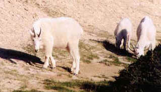 |
Continue our tour to Vancouver.
Return to Lewie's Home Page.