Fairbanks to Prudhoe Bay
The distance from Fairbanks to Prudhoe Bay is 80 miles on the paved Elliot Highway out of Fairbanks, and then 396 miles on the gravel Dalton Highway, originally known as the "Pipeline Road." With several short stops, and the slow speeds due to the gravel, two full days are required for this journey. In July, 1997, my wife and I drove the Dalton as far north as the Arctic Circle. At that point, I decided that I had enough of gravel driving, and we returned to Fairbanks. Ever since, I have wanted to travel on to the end of the road, and I am glad we did this time. I also am glad we were on a bus with a knowledgeable driver. Dust is not as bad as in 1997, and some parts of the highway are now being paved, but it is still a gravel road for almost all its length. There is less truck traffic now since Prudhoe Bay oil field activity is reduced. In 1997, we spent the night at a motel/restaurant/gas station, Yukon Ventures, on the north bank of the Yukon River. This time we spent the night at Coldfoot, located about 55 miles north of the Arctic Circle. These are the only motels that I am aware of between Fairbanks and Deadhorse, the very small town at Prudhoe Bay.
Anyone traveling this highway in a personal vehicle should be prepared to pay big bucks for a tow job back to Fairbanks if they have a vehicle problem. I saw no vehicle repair places of any sort along the highway. If you need a fan belt, or even a tire, you are not likely to find one unless someone brings it to you from Fairbanks. Don't expect your cell phone to function, either. A CB radio will allow you to talk with the truck drivers that you are likely to encounter. I did not check on the price of gasoline this trip, but in 1997, I paid $2.50 a gallon at Yukon Ventures! Gas was available at Yukon Ventures, Coldfoot, and at Deadhorse, so you don't have to carry enough gas for a round trip of almost 1000 miles.
|
|
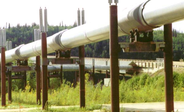
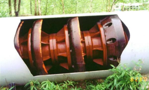
| The Alaskan Pipeline was the first stop as we left Fairbanks. A small park beside the road has a couple of pipeline "Pigs," one shown here, and explanations of how the pipeline functions. The top picture here is actually of the pipeline where it crosses the Yukon River. The pipeline is above ground for most of its length, and was seldom out of view during our Dalton Highway trip. |
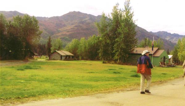
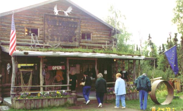 Our next stop was at Joy, Alaska. We had about three reasons for this stop. One was because our bus driver, John, had lived in a cabin here when he first moved to Alaska. A second reason was to see their gift shop, the largest one we would see until we returned from Prudhoe Bay. The third reason was to use their toilet facility. It can be seen just below the blue Alaskan flag, above. |
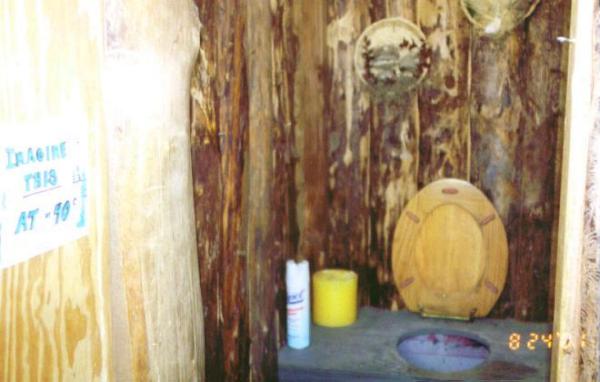 They have separate two-holers for men and women, each tastily decorated. Notice the sign on the door at left. The facility on the bus was more comfortable. |
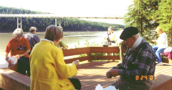 Next stop was lunch at the Yukon River. This small park was not here in 1997. It is across the highway from the Yukon Ventures where we stayed in 1997. The bridge in the background is the only bridge over the Yukon below Whitehorse, British Columbia. The pipeline is attached to the bridge. This picnic lunch, and another the next day, were only meals included in the land tour. |
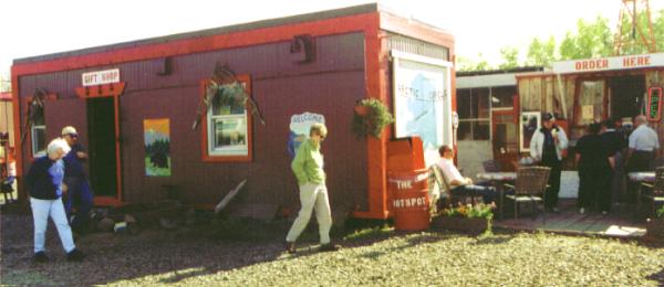 Next stop was at a small restaurant and gift shop named Hotspot. Several our bunch had ice cream. I got a small pin from the gift shop that says I crossed the Arctic Circle. |
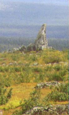
| We made one more stop before the Arctic Circle, at a small park that looks
out toward "Finger Rock". It was given this name because it looks like
an extended middle finger. In the small park are a number of information stands
that explain why there are groups of rocks in a circle in the area (caused by
frost heave), and about the animals and plants commonly seen in the area. We
also stopped at this park in 1997. |
 |
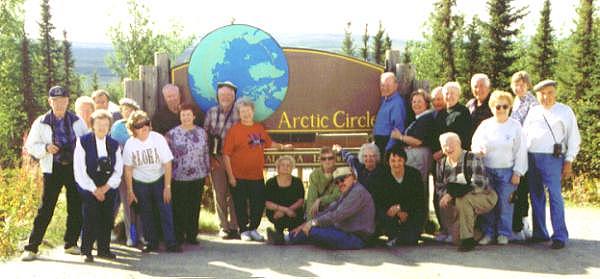 We took a group photo at the Arctic Circle sign. There is a small park, with a parking lot just off the highway. My GPS receiver agreed that this was the Arctic Circle. Perhaps the best part of our tour was the people. Everyone in our group came to be good friends. We varied in age from the late 20's to about 80. John, our bus driver, was a friend to all. He has been driving this tour for the last few years and knows what to expect all along the route. He was a good driver, and good at keeping us informed about the areas we were passing. He also knew about the animals and vegetation that we encountered. His knowledge seemed to be way beyond what might be expected of a bus driver, and approached that of a naturalist. |
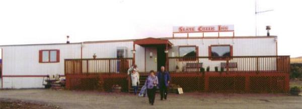 The Coldfoot Hotel is the Slate Creek Inn. |
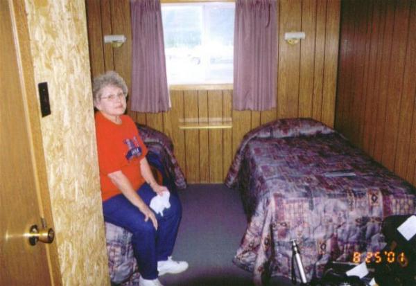 The accommodations are simple, but adequate. This is better than Yukon Ventures in 1997. |
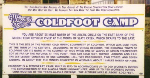 |
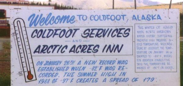 These two signs are posted by the road at the entrance. The hotel name has changed. |
 After leaving Coldfoot, on Saturday, 25 August, Wiseman, Alaska, was our first stop. A couple of the dwellings can be seen toward the left, and the new post office is the green building with the flags. Wiseman is still occupied by 30 or so people, but their are no stores or services other than the post office. The old post office still stands, but it is a log building that is slowly sinking into the ground. |
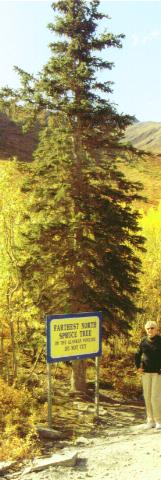
| Spruce trees are the only tree of significant size that
survives this far North. This one is the farthest North in Alaska. The
last line of the sign is "DO NOT CUT." It is located just a few
feet from the road, and no other trees are nearby.
Before reaching this tree, a sign was passed that announced "Entering the North Slope Borough, The Worlds Largest Municipality." It is 89,000 square miles in size, 650 miles wide. It includes a school district of the same size. The school district pupil population is approximately 2,250, primarily Eskimo. More information can be found at http://www.nsbsd.org/ , and at http://www.north-slope.org. |
 |
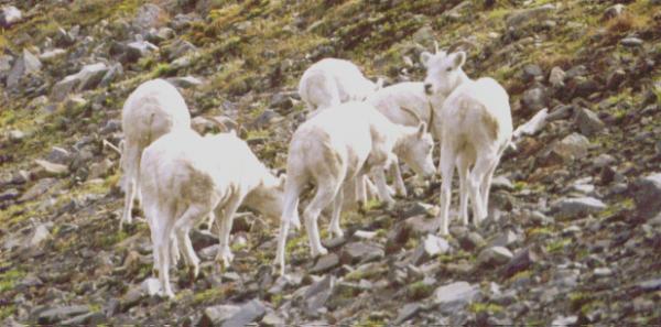 Just after passing the highest point of the road through the Brooks Mountain Range, we saw many Dall Sheep. Dall sheep have horns much like mountain goats, but the horns are not black. This was part of the first group. A second group was seen about 200 yards farther, and across the road from this group. Another group was seen about a mile farther. |
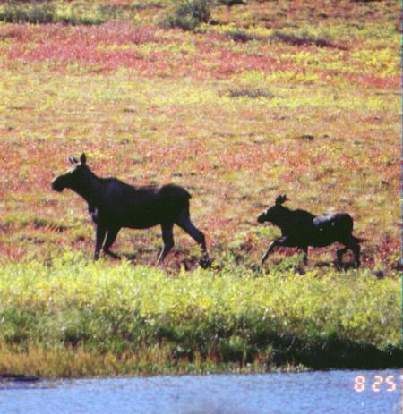 Next stop was to take pictures of a moose cow and calf. They were feeding at a small lake beside the road. Notice the colorful plants in the background. Late August is the fall season this far North. The plants of the tundra turn yellow and red in the fall just as trees do farther south. |
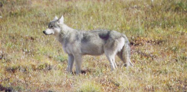 As we proceeded north on the Dalton Highway, a group of about 10 Dall Sheep were seen running like their life depended on it. A little later we saw why. Two wolves were in the area where the sheep had been. The wolves were near the top of a ridge that paralleled the highway when we first saw them. The bus was parked just off the road below where the wolves were seen, and we had our picnic lunch. After lunch, as the bus pulled out and headed north, we noticed that one of the wolves had come down the hill partway. As we watched, the wolf made its way down to where the bus had been parked. The driver turned the bus around and hurried back. The wolf was by the road. Two swans were on a small pond across the road, and the wolf might have been headed there for lunch. There is nothing in the picture for size reference, but the wolf is a very large animal. |
As we drove north, we saw a few caribou, and one group of Musk Ox too far away for good pictures. Several times we saw extremely bright rainbows in the mountains, but never an arc across the sky. Only an end near the ground, but brighter than any I have seen before.
We had a delay at a road construction site about 5 PM. All traffic was stopped for about an hour so large gravel trucks had a clear roadway to return to their parking area. We were first in a line of less than a half dozen vehicles delayed by the hour stoppage. As we approached the coastal area, fog became a major problem. Our driver reported that fog caused by a wind blowing off the Arctic Ocean was common this time of year. The area near the coast is almost flat, with lots of water everywhere. The sun evaporates the water, which turns to fog when the cold breeze blows. We saw more caribou, and a few bow hunters after caribou, near the road, but it was too dark for pictures.
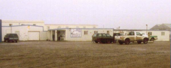 The hotel, the Arctic Caribou Inn, at Deadhorse is similar to the hotel at Coldfoot, but it is larger, partly two stories, and has the dining area in the same building. Television from a satellite is also available in all rooms. It is the only public hotel in town. The oil companies have their own facilities. |
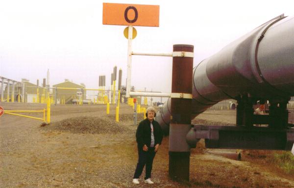 That is my wife Betty standing at milepost zero of the Alaskan Pipeline. In the background is Pump Station One. |
|
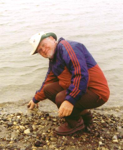
The morning after one night in the Caribou Inn, we had a narrated tour of the Prudhoe Bay oil field. Most of the tour was just driving past some of the historic parts of the oil field, but we did make two stops. One was at the start of the pipeline, and the other was at a small gravel beach where we could touch the water if we wished. After the tour, we were delivered to the airport to catch our flight to Anchorage. That is me with my fingers in the Arctic Ocean. Some others on the tour took off a shoe and got a foot wet, but I was too cold. The temperature was barely above freezing, and there was a strong wind from the north. |
 |
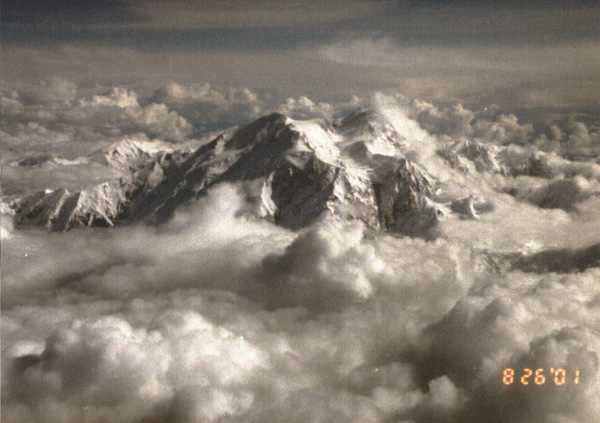 On the flight from Deadhorse to Anchorage, we flew by Mt. McKinley. The pilot announced the presence of the mountain, and then flew around it so that people on either side of the plane had a good view before we left. When we visited Denali in 1997, and again during this tour, clouds such as are seen here prevented our seeing the top of the mountain from the ground. We did see the top of the mountain from Anchorage, but haze prevented getting a distinct look. This was our first time to get a good look at the top of Mt. McKinley, also known as Denali Mountain. |
Continue to Our Cruise.
Return to Lewie's Home Page.
Return to Our Scenic Tour of 2001.
Return to Anchorage to Fairbanks.